Students propose ideas for spatial development improvement for Yancheng District
2022-02-11
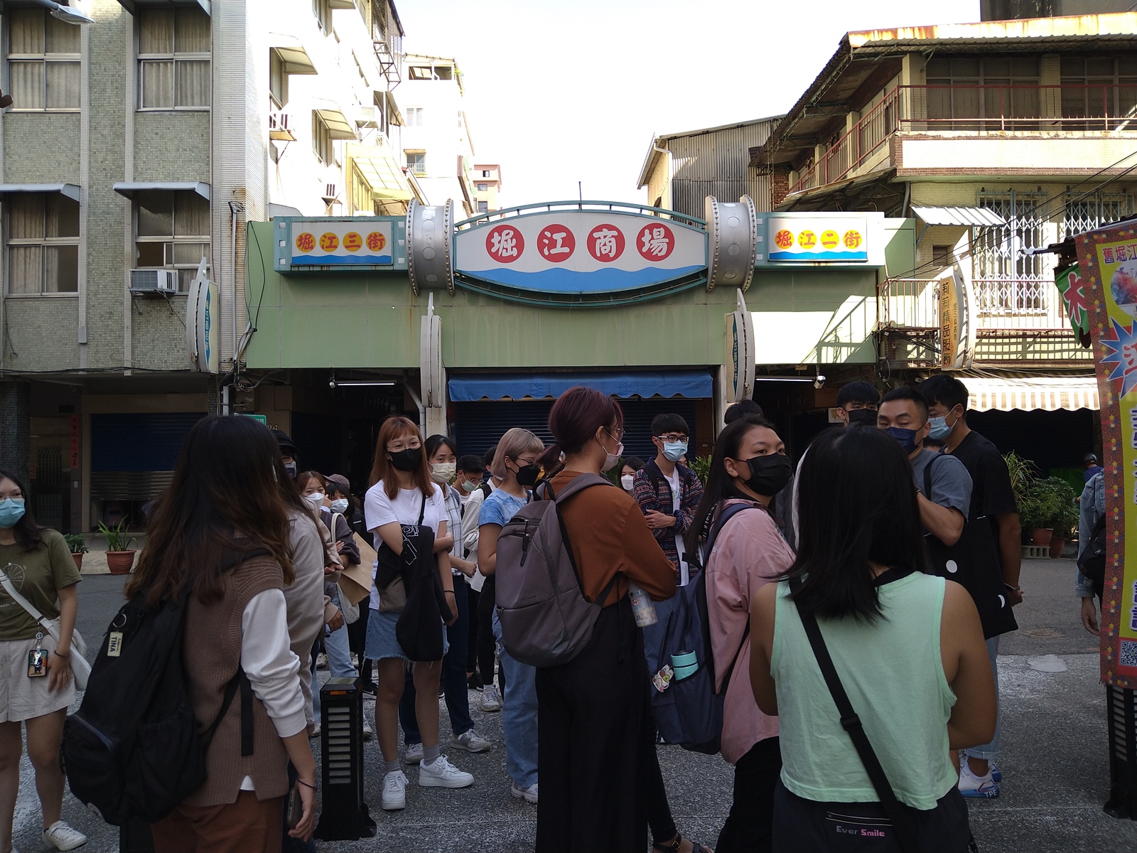
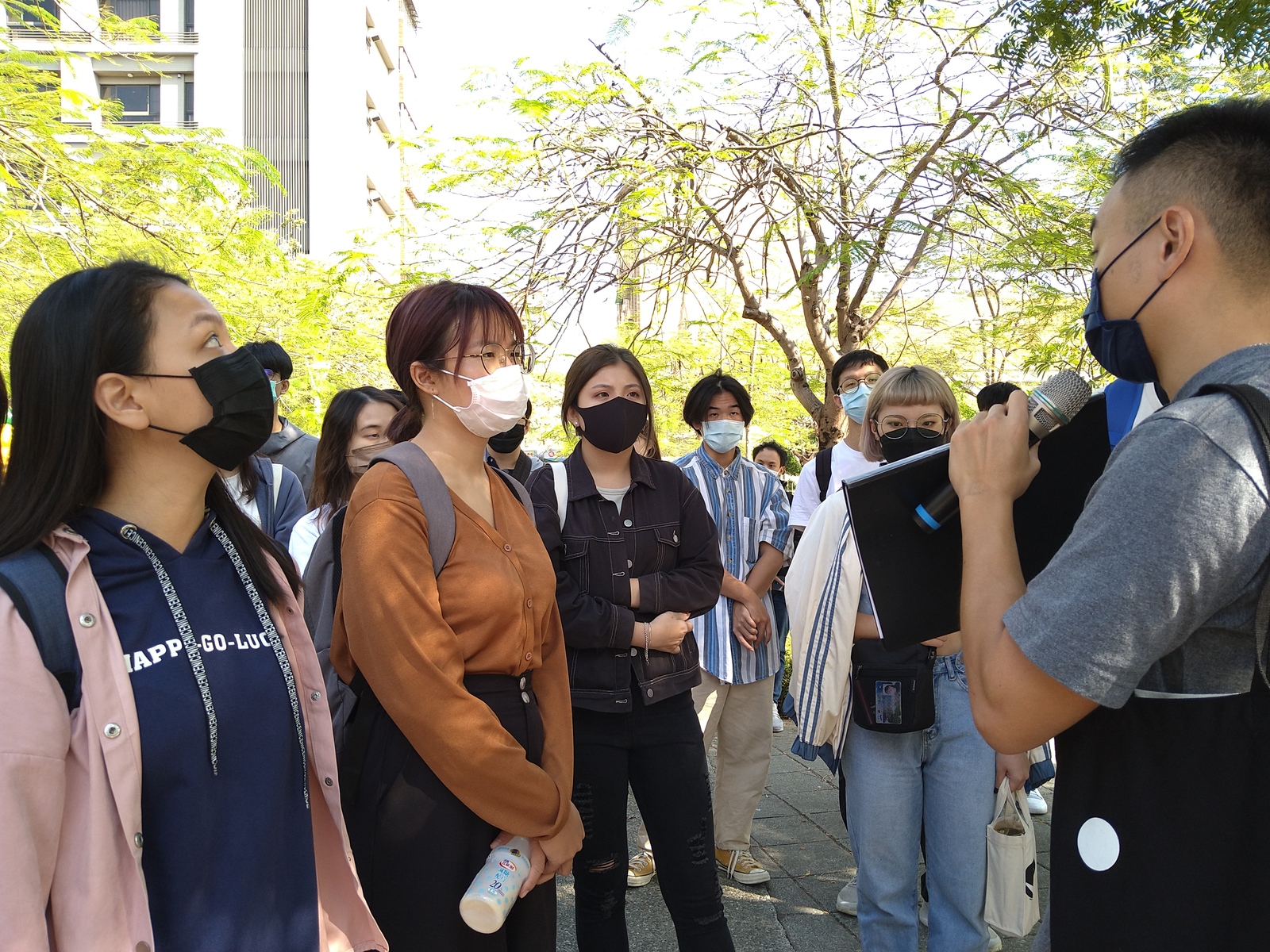
(Provided by Program in Interdisciplinary Studies) The Program in Interdisciplinary Studies at National Sun Yat-sen University opened a course in “SSpatial Investigation, Analysis and Planning”. The students and teachers observed and recorded spatial development issues and improvement possibilities in the area south of the Wufu Road in Yancheng District, analyzed the survey data and proposed strategic spatial planning ideas for improving the quality of life and tourism in the study area. The course proposed nine major planning concepts, including the conversion of old buildings and vacant space, and reshaping such landmarks as the railway, the port area and the market. Besides conducting surveys during on-site visits, the students learned to use Google Maps to record survey results and Sketchup to create 3D spatial drawings and present strategic spatial planning ideas through digital technology to achieve the goal of combining humanities with technology.
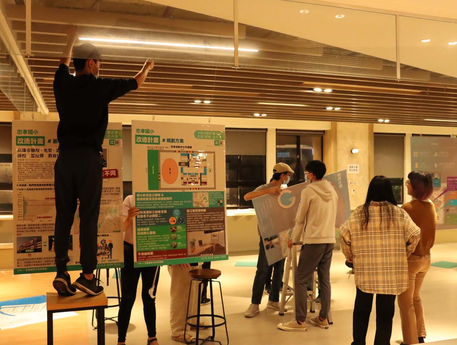
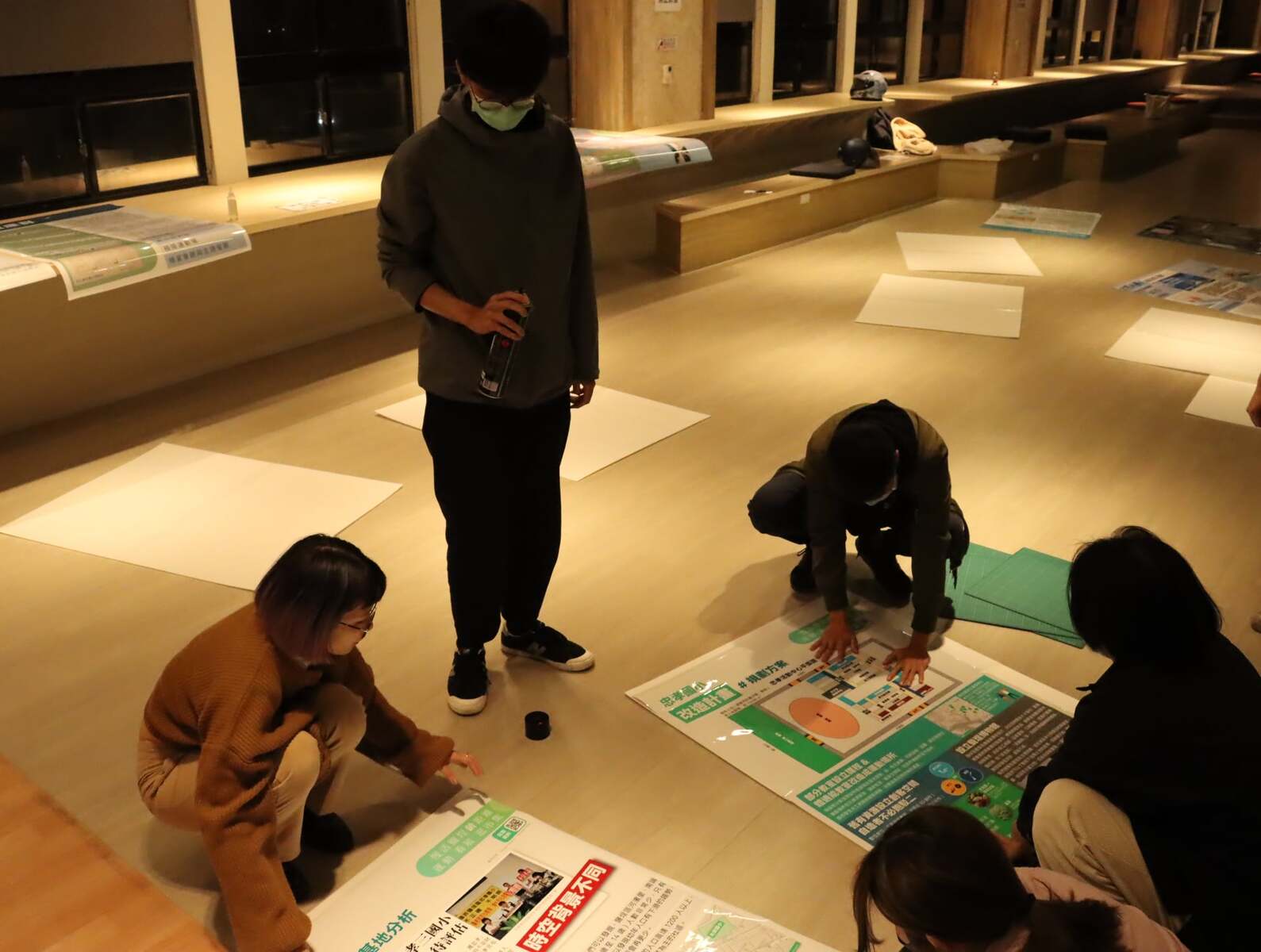
Students’ study results of the “Spatial Investigation, Analysis and Planning” course were displayed in an open presentation and end-of-semester exhibition. In an on-site survey, "Southeast Yancheng" found out that there are many old houses and illegal buildings north of Gongyuan Road and so the idea to “demolish old houses and build new residences to extend the living space of the residents through the establishment of an activity center and open space” was proposed. The students found that Huahsia Building has insufficient open space and little space for pedestrians, and so their proposal included “increasing the pedestrian space when building new residences after demolishing the existing buildings.” “The World” used the vacant waiting room and the Taiwan Beer company to create space for lodging and creative activities, such as taking the visitors on a journey back in time to Kaohsiung as a shipbreaking hub through DIY workshops. The Pier-2 Family-Friendly Neighborhood Plan is a planning proposal aiming at creating a family-friendly neighborhood by re-arranging the space and redirecting the flow of families-tourists into Yancheng alleys around the Pier-2 Art Center.
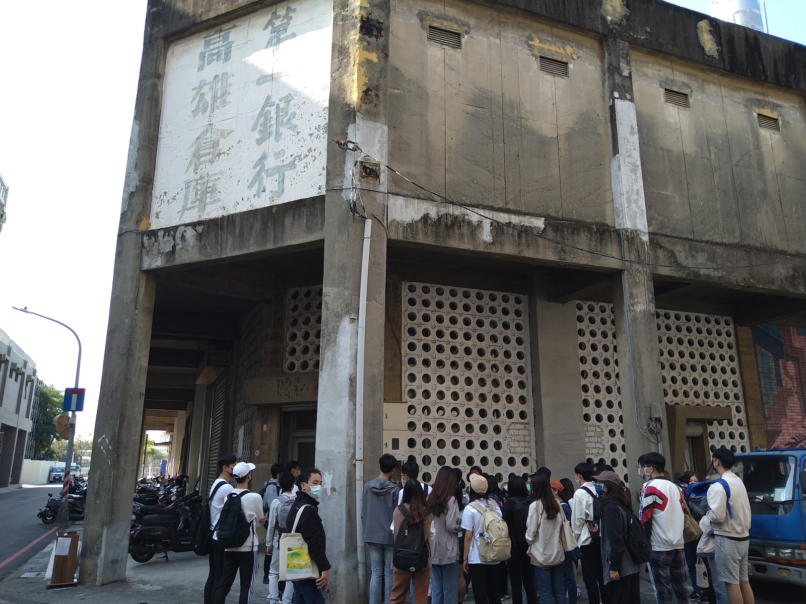
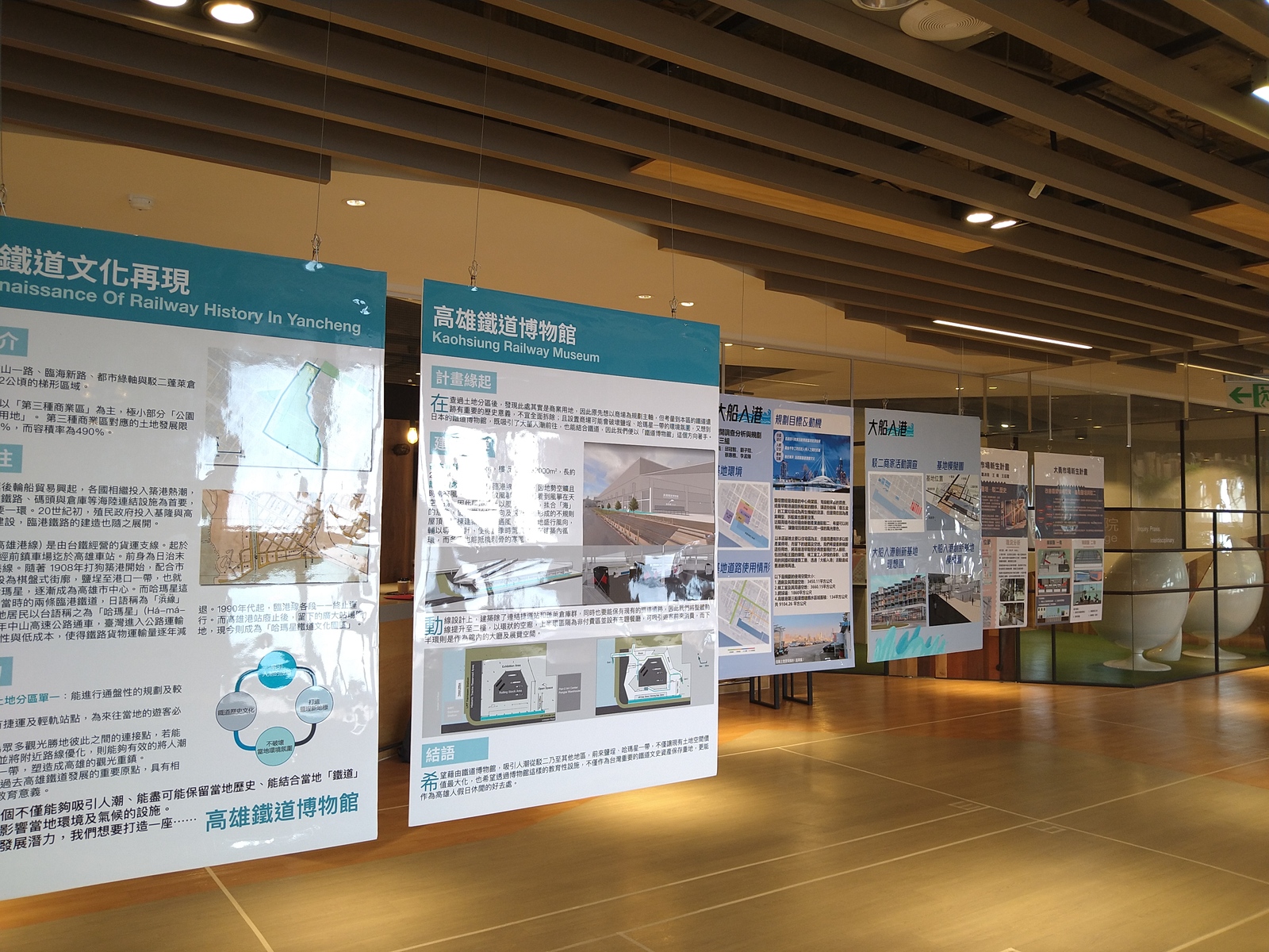
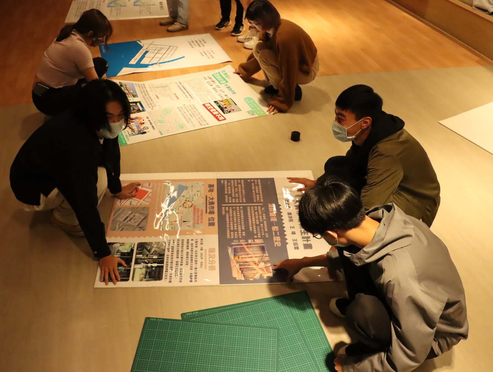
The attempt to plan a railway museum in the Hamasen Railway Cultural Park to revive the railway culture in Yancheng aimed at creating an attractive new landmark while preserving the railway history, culture, and the local environment. The Dayong Market Revitalization Project attempted to revitalize the decaying market space by introducing arts, cultural activities, and local Yancheng stories. Yancheng Underground Street 2.0 involved setting up a shopping center, hoping to attract more visitors. Kaohsiung Port Warehouses Project proposed three major improvement policies, combining 410 stores, creating a gathering place for youth, and an indoor and outdoor culture & creativity base with various themed restaurants and culture & creativity markets to attract tourists. Kaohsiung Municipal Jhongsiao Elementary School Renovation Project recognized that the school-age population in Yancheng District is likely to gradually decrease in the future, so three elementary schools: Jhongsiao, Yancheng, and Guang Rong are bound to face a merger in the future, and so the surplus space can be transformed into community classrooms or creativity spaces.
Assistant Professor Hao-Ching Hsia of the Program in Interdisciplinary Studies said that Pier-2 Art Center attracts nearly 4 million visitors every year but still, this did not bring significant development to Yancheng. There are still many spatial planning issues in the area that need more investigation and analysis, and in the future, the course will continue to focus on spatial planning possibilities in Yancheng. A sophomore of the Program in Interdisciplinary Studies, Ru-Ying Fang, said that as the course integrates theory and practice, it has definitely not been a piece of cake: besides listening to lectures, the students had to actually go to the site, investigate, and plan. Many tools introduced in class, such as Google Maps, Streetmix, Sketchup helped achieve more concrete and clear final results.
(Edited by Public Affairs Division)
(Provided by Program in Interdisciplinary Studies) The Program in Interdisciplinary Studies at National Sun Yat-sen University opened a course in “SSpatial Investigation, Analysis and Planning”. The students and teachers observed and recorded spatial development issues and improvement possibilities in the area south of the Wufu Road in Yancheng District, analyzed the survey data and proposed strategic spatial planning ideas for improving the quality of life and tourism in the study area. The course proposed nine major planning concepts, including the conversion of old buildings and vacant space, and reshaping such landmarks as the railway, the port area and the market. Besides conducting surveys during on-site visits, the students learned to use Google Maps to record survey results and Sketchup to create 3D spatial drawings and present strategic spatial planning ideas through digital technology to achieve the goal of combining humanities with technology.
Students’ study results of the “Spatial Investigation, Analysis and Planning” course were displayed in an open presentation and end-of-semester exhibition. In an on-site survey, "Southeast Yancheng" found out that there are many old houses and illegal buildings north of Gongyuan Road and so the idea to “demolish old houses and build new residences to extend the living space of the residents through the establishment of an activity center and open space” was proposed. The students found that Huahsia Building has insufficient open space and little space for pedestrians, and so their proposal included “increasing the pedestrian space when building new residences after demolishing the existing buildings.” “The World” used the vacant waiting room and the Taiwan Beer company to create space for lodging and creative activities, such as taking the visitors on a journey back in time to Kaohsiung as a shipbreaking hub through DIY workshops. The Pier-2 Family-Friendly Neighborhood Plan is a planning proposal aiming at creating a family-friendly neighborhood by re-arranging the space and redirecting the flow of families-tourists into Yancheng alleys around the Pier-2 Art Center.
The attempt to plan a railway museum in the Hamasen Railway Cultural Park to revive the railway culture in Yancheng aimed at creating an attractive new landmark while preserving the railway history, culture, and the local environment. The Dayong Market Revitalization Project attempted to revitalize the decaying market space by introducing arts, cultural activities, and local Yancheng stories. Yancheng Underground Street 2.0 involved setting up a shopping center, hoping to attract more visitors. Kaohsiung Port Warehouses Project proposed three major improvement policies, combining 410 stores, creating a gathering place for youth, and an indoor and outdoor culture & creativity base with various themed restaurants and culture & creativity markets to attract tourists. Kaohsiung Municipal Jhongsiao Elementary School Renovation Project recognized that the school-age population in Yancheng District is likely to gradually decrease in the future, so three elementary schools: Jhongsiao, Yancheng, and Guang Rong are bound to face a merger in the future, and so the surplus space can be transformed into community classrooms or creativity spaces.
Assistant Professor Hao-Ching Hsia of the Program in Interdisciplinary Studies said that Pier-2 Art Center attracts nearly 4 million visitors every year but still, this did not bring significant development to Yancheng. There are still many spatial planning issues in the area that need more investigation and analysis, and in the future, the course will continue to focus on spatial planning possibilities in Yancheng. A sophomore of the Program in Interdisciplinary Studies, Ru-Ying Fang, said that as the course integrates theory and practice, it has definitely not been a piece of cake: besides listening to lectures, the students had to actually go to the site, investigate, and plan. Many tools introduced in class, such as Google Maps, Streetmix, Sketchup helped achieve more concrete and clear final results.
(Edited by Public Affairs Division)
Click Num:
Share